Message from the Aral – Documentary Photography by Iulia Galushina
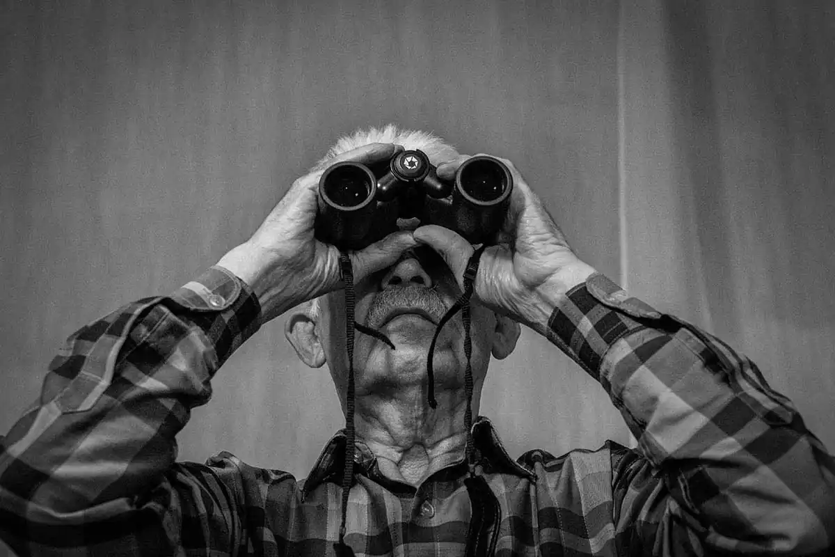
Scientist from Kazakhstan Boris Smerdov is 77 years old. Half a lifetime he has spent “deeply worried about” the Aral Sea. On retirement, the scientist has been descrambling the secret signs he discovered at the bottom of the Aral Sea.
Feb 26, 2018
Maps of the Aral Sea.
Before the Aral expedition, Boris Afanasievich bought very detailed maps published in 1987 and 1964. The scale of the first map is 1: 500,000 in one centimeter 5 kilometers, of the second one, 1: 1,000,000, in one centimeter 10 kilometers. The scientist applied the location of Aral signs and channels from the Small Sea to Great Sea. He still cherishes these maps.
Scientist from Kazakhstan Boris Smerdov is 77 years old. Half a lifetime he has spent “deeply worried about” the Aral Sea. On retirement, the scientist has been descrambling the secret signs he discovered at the bottom of the Aral Sea.
The border between Kazakhstan and Uzbekistan runs along the Aral Sea. The Aral Sea was one of the largest lakes on the planet, but in 1961 the water level in the Aral Sea began irresistibly falling, catastrophically fast. In the Uzbek port of Muynak, for one of the nights of shallowing, the water level lowered by two hundred meters. In the morning the people ran after the sea and cried. A fishing boat, which had landed on the beach for the night, was not able to set sailing in the morning. Today the seabed has turned into a desert. On its bare bottom Boris Smerdov discovered mysterious signs. The scientist is sure – this is the message of extraterrestrial civilization to the inhabitants of the Earth.
– I’ve been studying the secret symbols of the Aral Sea for a quarter of a century. My feeling of admiration is not passing off. For me, the Aral signs do not lose their attractiveness, beauty, complexity and mystery. Strange as it may sound, but I hold a cordial affection for them as for the creatures, very close and rich in their essence.
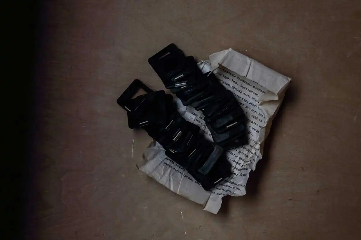
The cupboards, beneath the bed, the balcony of the one-room apartment of the scientist are full of hundreds of folders, drawings, letters, diagrams, photographs, and pictures. In the refrigerator, under carrots and potatoes there are samples of soils from the mysterious furrows of the Aral Sea. Boris Smerdov is sure that these furrows are of nonearthy origin. “What an amazing fact! My wealth! I have been sitting with this wealth for more than 25 years, not knowing what to do with it. Making analysis of the samples is too expensive for me”.
In 1987, the Aral Sea was divided into the Great and Small Seas – the Southern and Northern Aral, forming a narrow channel between them.In an effort to save the water, at least in the Small Sea, in 1992, on the isthmus between the North and South Aral, a dam was built. It was built by local forces and at their own cost and expense from reels of cane, stones, sand and clay using technologies of the Stone Age. The sand dam was washed away. Three times a dam between the Small and Great Seas was erected by “rule of thumb”, and three times was washed away.In 1999 a mighty stream washed the dam between the Great and Small Seas away ones again. Water washed away not only the dam but also the lower part of the Aral signs. During the Kokaral dam construction in the Small Sea heavy trucks erased the remaining part of the signs. The secret signs have gone before they had a chance of being widely interested in and studied. Information about the Aral signs is recorded on the aerial photos which Boris Smerdov stores carefully.
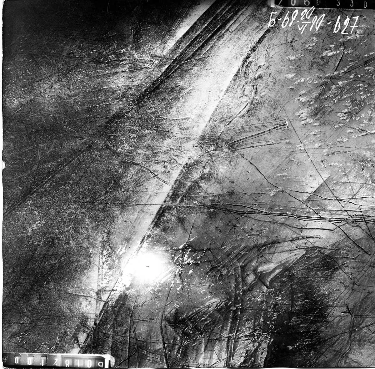
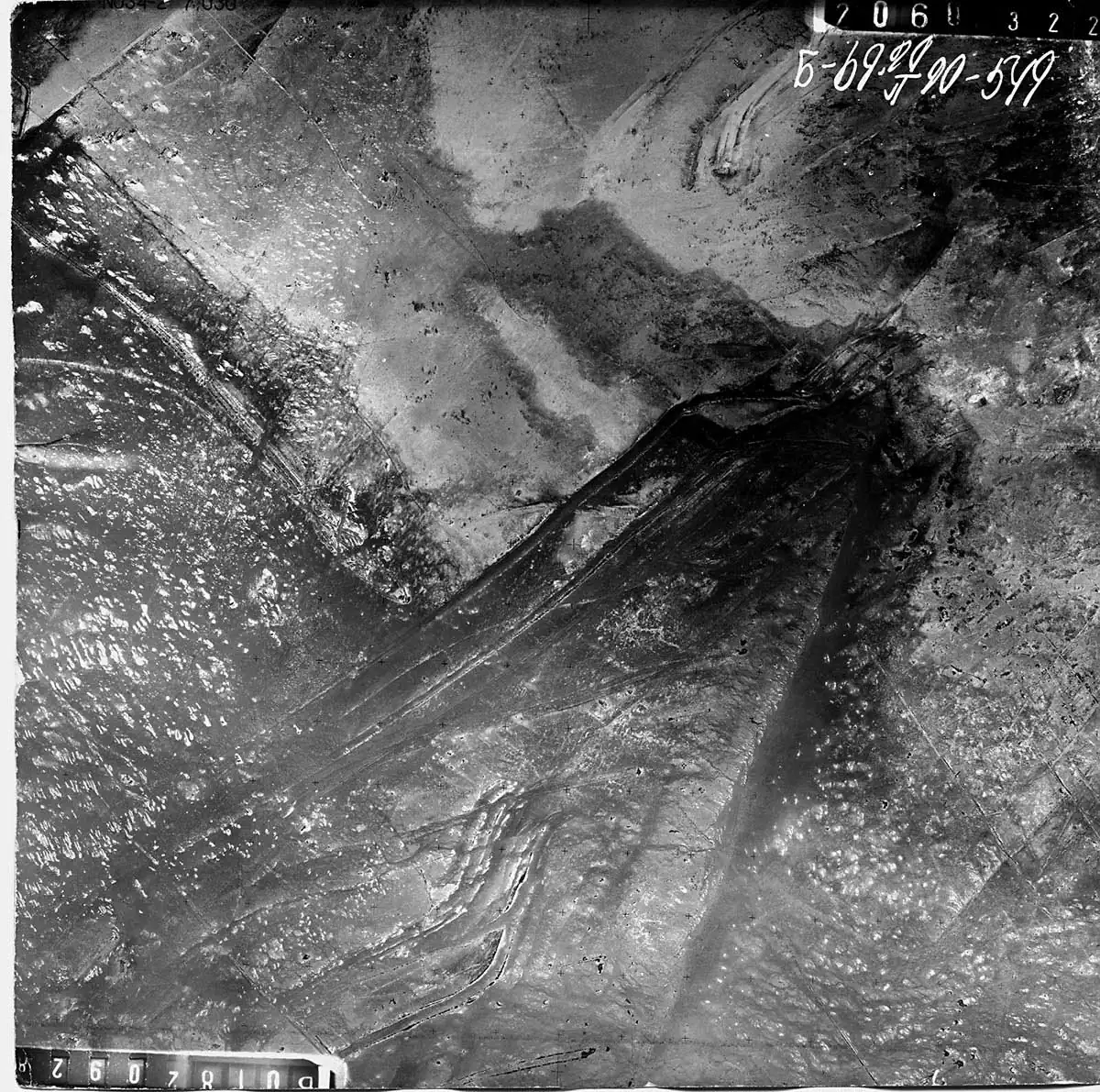
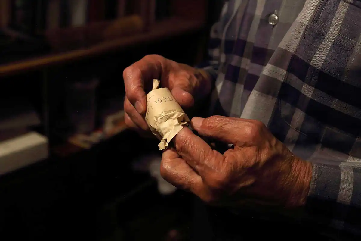
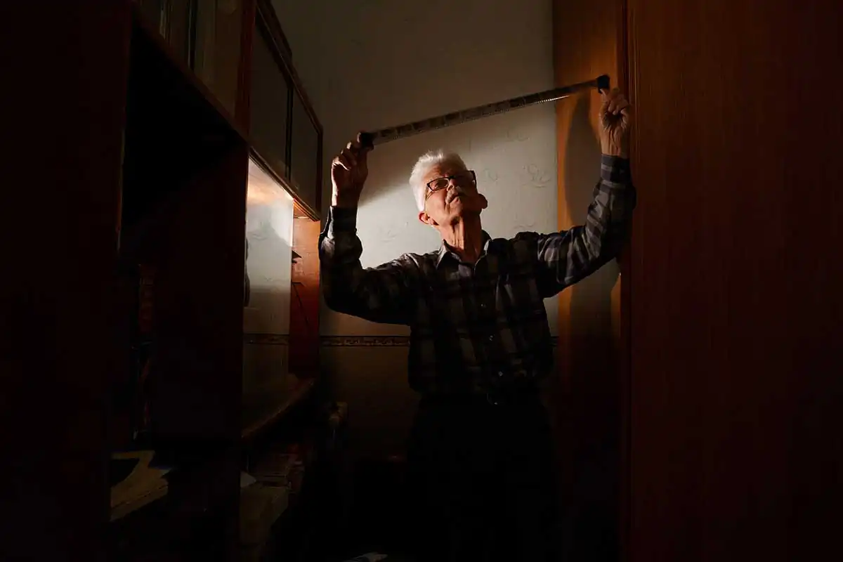
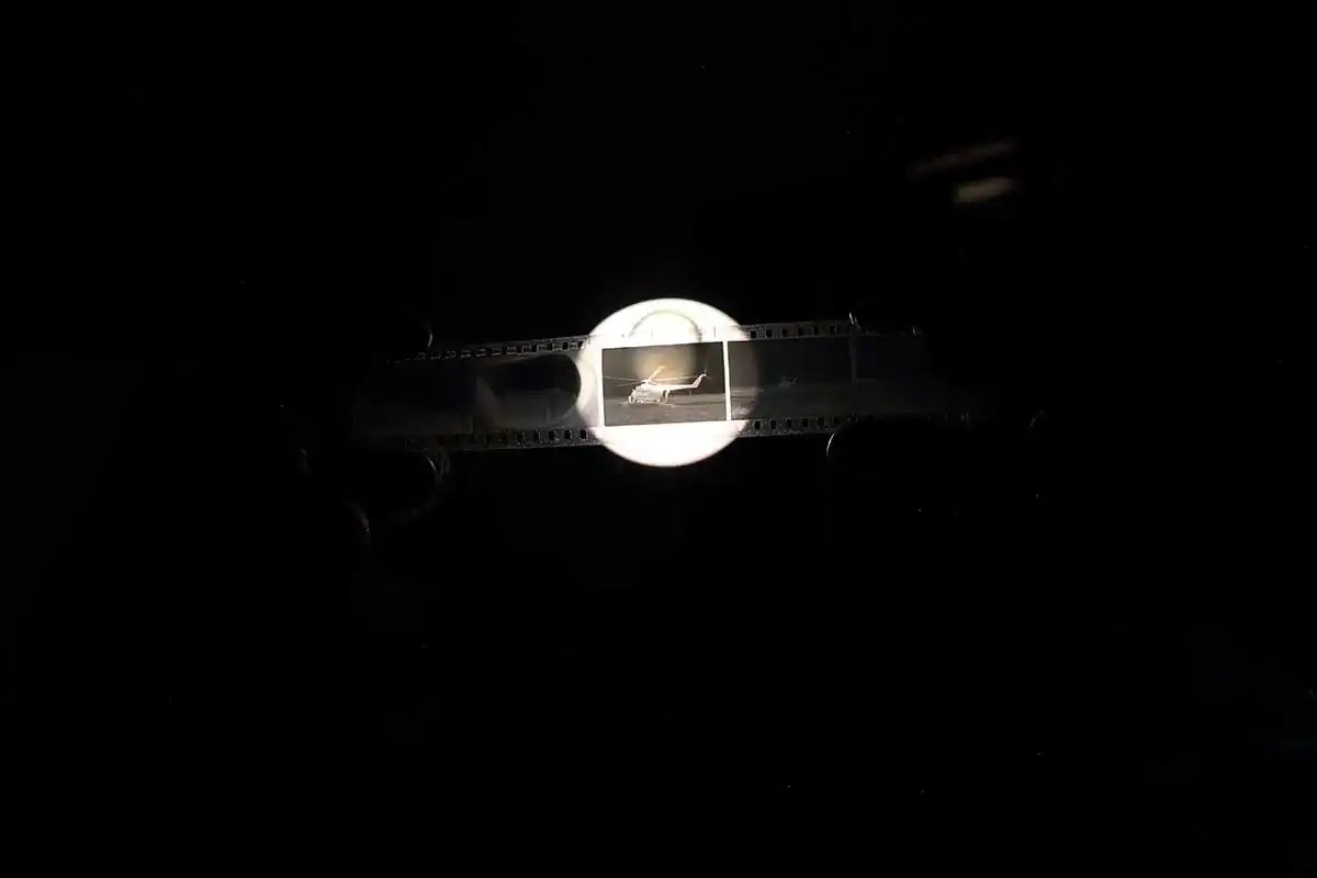
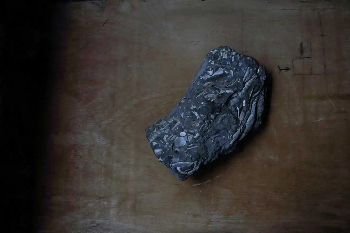
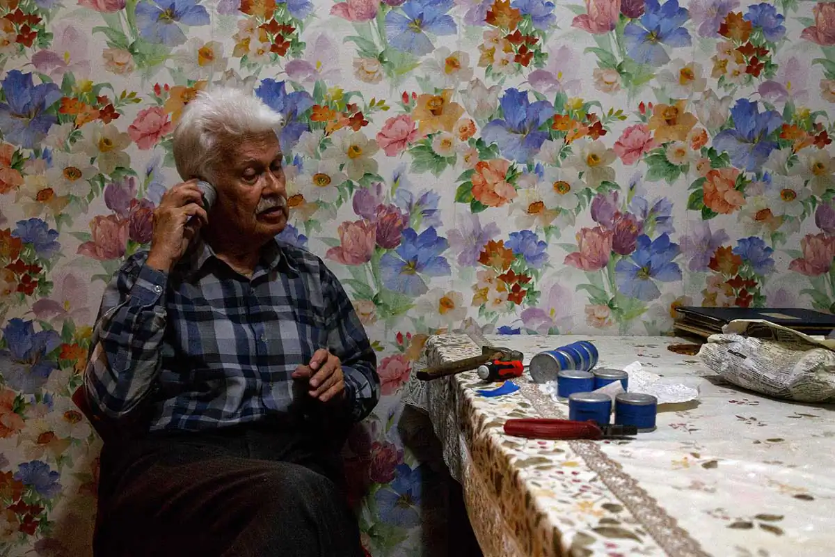
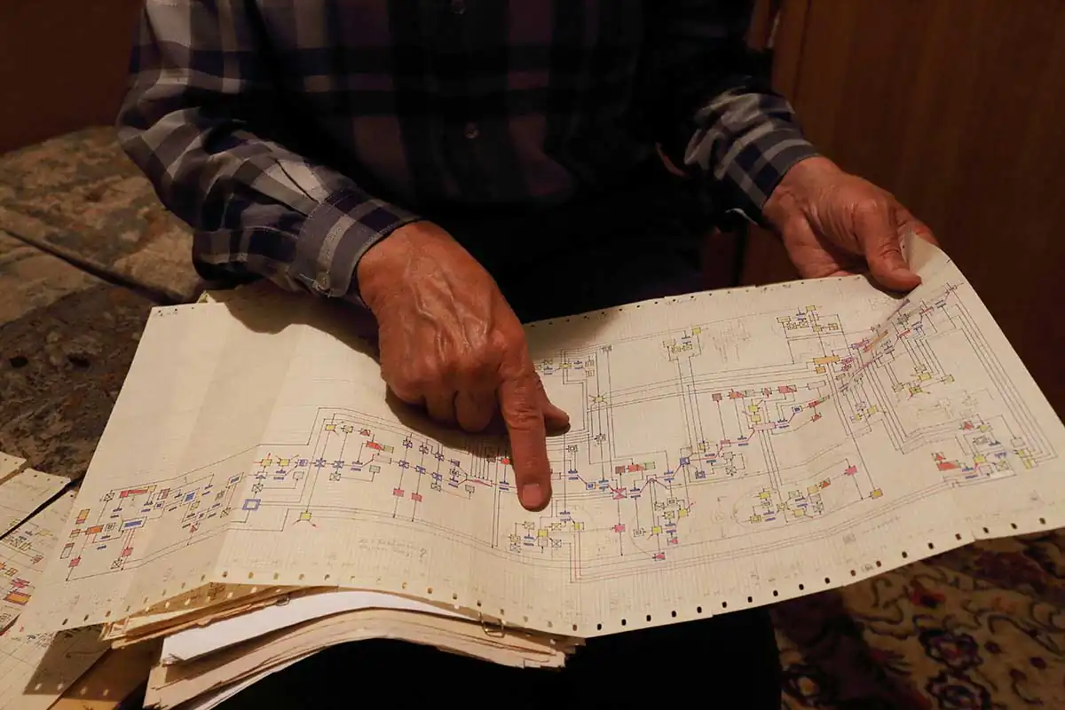
Slides of the 1910-2010’s, showing the level of seasonal and perennial fluctuations of the Aral Sea. In 1963, Boris Smerdov graduated from Tomsk State University, specializing in Land Hydrology. He was doing postgraduate studies in Hydrology at Krasnodar Agricultural Institute. In 1980 he joined Kazakh Research Hydrometeorological Institute in Alma-Ata. The young scientist monitored the Aral Sea level in different parts of it. He compiled graphs, studying the sea regime using them, and investigating its trends. – I saw the Aral Sea level steadily falling since 1961. But there was no any serious concern about it. I thought it was one of the temporary fluctuations. The sea water level was changing regularly. Furthermore, the Aral sea level had shallowed before, moreover, it was a dry land. The Aral Sea emerged about 10,000 years ago, when the Amu Darya River, which until then had run into the Caspian Sea, turned north and began filling with water a tectonic depression – a large southern part of the future Aral Sea. Before, only the Syr Darya flowed into this depression, feeding a relatively small pond. According to some scientists, the Amu Darya turned several times toward the Caspian Sea, according to others, the river turned away from the Aral only once. And at that time, the Aral Sea began shallowing. In 2001, on the dry bottom of the Aral, the inhabitants of the village of Karateren, and then archaeologists, discovered an ancient settlement and a large mausoleum. Then people joked that the Kazakhs had found the Aral Atlantis. The artifacts confirmed that there existed a town on the bottom of the Aral Sea: its townsfolk built houses, erected mausoleums, and engaged in agriculture. The sea was a dry land at that time, but the water came back. About 150 years ago, “water lavishly flooded the land” more than ever. The Aral made the top four lakes on the planet. Our fathers and grandfathers remembered the Aral as blue and full of fish.Photo from the Boris Smerdov’s archive. Two “Rockets” under the water. The length of each is 600 m.Photo from the Boris Smerdov’s archive. «Car entry and a snake», aerial photo 1990. -This shot I called «Car entry and a snake». It is the most exciting for me. Width of wheel track of so called “car” which entered by the steep slope is 250 meters, while “wheel” width is 50 meters. From the left top corner of the picture a “snake” is going down and her head almost touches the wheel track. Using 100-200 times magnification “scales” of the “snake” are clearly seen. The “scales” look like cells and require further investigation. No earth technique is able to draw such huge and smooth furrows on the seabed. I calculated that the drawing of these Aral signs will require a continuous operation of 90,000 twenty-ton vehicles for 25 years. – I consulted and shared my findings with geologists, geophysicists, geographers, astronomers, ufologists, mathematicians, designers, including in the field of underwater military technology – with anyone who could show interest in the Aral signs. All scientists shrugged shoulders and took me for an eccentric. I had to continue the study alone, relying only on wife’s and children’s support.Boris Smerdov unpacks a film from year 1990 expedition. Aral is everywhere in one-room apartment of the scientist. Folders with drawings and formulas, letters, maps, tens of films – all what have collected for 25 years of communication with Aral. Scientist carefully store every sheet of paper, every record.Boris Smerdov is looking at film from year 1989 expedition.Helicopter MI 8. In 1989 году five employees of the Kazakh Scientific and Research Hydrometeorological Institute, flew to the Aral Sea for sand samples.A stone sample from the southern part of the Kokaral Peninsula. Boris Smerdov have been studying Aral for a quarter of century. He visited it’s shores many times. The scientist returns from the sea laden with stones – he got a full backpack. Smerdov was especially impressed by this stone with innumerable inclusions of shells.Aluminum sample boxes for soil samples. Inside – soil samples from the Aral signs. The sample boxes are numbered, sealed with adhesive tape. Information about the samples is written in the scientist’s notebook. – In 1996, our guide Margulan Zheksembiev found two furrows on the eastern dried sea coast – two Aral Traces, – says Boris Afanasyevich. – Margulan is a resident of aul Karateren, an observer of a hydrological post on the Syr Darya River, one of the best connoisseurs of his land, a guide to several foreign expeditions in the Aral Sea region, a longtime friend of mine and a participant in the work in the lower reaches of the Syr Darya. He was in the know about the Aral signs and was very interested in their search and study. I made a cross-section of a furrow and brought samples of soil and algae to Almaty. For 20 years the land from the Aral Sea was stored in a refrigerator, tightly packed in sample bottles. I never opened them. So I do not know in what condition they are, especially the algae. I do not open them, I’m afraid to break something important. I did not send them to the laboratory, because I did not have enough money.Boris Smerdov is looking into binocular which shows azimuth. The scientist from Almaty was offered to write a book about the Aral signs. The French Data Bank of Abnormal Phenomena got interested in the strange lines on the Aral bottom. The French offered to send their employee to conduct joint research, and Boris Smerdov was required to cover the cost of his stay in Kazakhstan and travel to the Aral Sea. An ordinary scientist could not afford it because of high costs. – Traces of the Aral Sea do not let me go. The Aral furrows were drawn under a 15-m water column at a time when the sea was deep. Who covered the seabed with lines and why? I have more questions than answers.The scheme of Boris Smerdov’s life. The scientist drew 30 variants of the schemes of his life, each time remembering and adding new events. – “Before meeting the Aral signs, I was an atheist, and when I was looking into the secret of the Aral Sea, I became a fatalist”, the scientist admits. “I’m sure everything in life is not incidental”. Only by a lucky chance the Aral signs were covered by aerial survey. By chance, when choosing a profession, I entered hydrology faculty, although all my life I am in awe of radio engineering and optics. All events in life are naturally determined. To make sure of this, I made a scheme of my life. Using different colors and forms I marked transitional moments, studies, research work, intentions, deadly dangerous moments … This is the moment when my father took away my grenade; that, when the lightning struck me; and these are Krasnoyarsk poles where I was about to fall … I drew more than 30 variants of my life schemes, every time remembering and adding new events. I included less than 100 elements in the first scheme, in the last one, more than 400. The scheme of my life is similar to the scheme of a complex electronic device with several functional blocks. And at its output there are events related to the discovery and decoding of the Aral signs.
We use cookies on our website to give you the most relevant experience by remembering your preferences and repeat visits. By clicking “Accept”, you consent to the use of ALL the cookies.
This website uses cookies to improve your experience while you navigate through the website. Out of these, the cookies that are categorized as necessary are stored on your browser as they are essential for the working of basic functionalities of the website. We also use third-party cookies that help us analyze and understand how you use this website. These cookies will be stored in your browser only with your consent. You also have the option to opt-out of these cookies. But opting out of some of these cookies may affect your browsing experience.
Necessary cookies are absolutely essential for the website to function properly. This category only includes cookies that ensures basic functionalities and security features of the website. These cookies do not store any personal information.
Any cookies that may not be particularly necessary for the website to function and is used specifically to collect user personal data via analytics, ads, other embedded contents are termed as non-necessary cookies. It is mandatory to procure user consent prior to running these cookies on your website.